
Niger State is one of the 36 states in Nigeria, located in the north-central region of the country. The state is known for its rich cultural heritage, natural resources, and tourist attractions. In this article, we will explore some interesting facts about Niger State that you may not know. From its history to its economy, geography, and demographics, we will provide you with an in-depth look at this fascinating state. So, whether you are a resident of Niger State or just curious to learn more about it, read on to discover some amazing facts about this Nigerian state.

Creation Of Niger State
Niger State was created on February 3, 1976, during the regime of General Murtala Mohammed. Prior to its creation, the area that is now Niger State was part of the North-Western State.
Niger State Meaning
The state was named after the River Niger, which is the third-longest river in Africa and flows through the state. The river is an important source of water, transportation, and irrigation for the people of Niger State and other parts of West Africa.
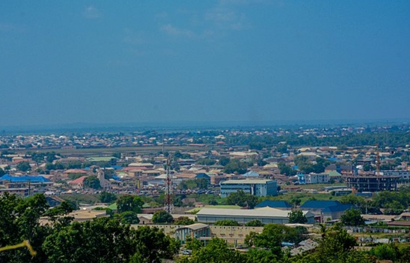
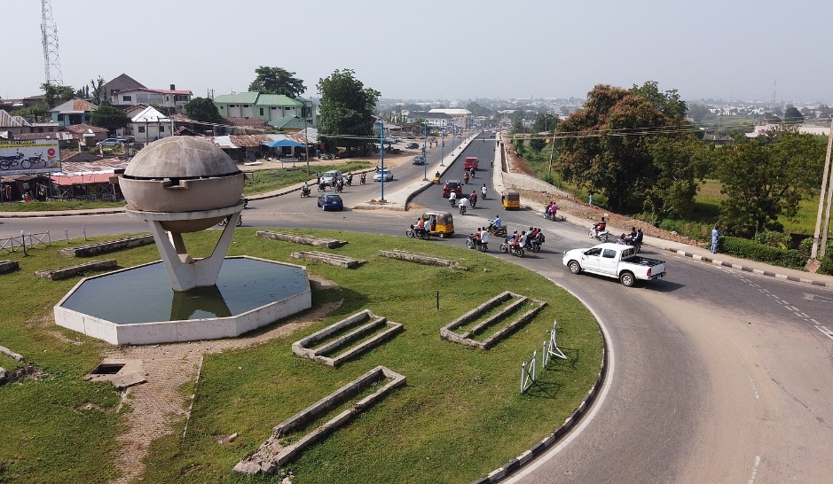
Niger State Capital
The capital of Niger State is Minna. It is located in the central part of the state and serves as the administrative, commercial, and political hub of the state. Minna is also home to several government institutions, higher institutions of learning, and tourist attractions.
Niger State Slogan
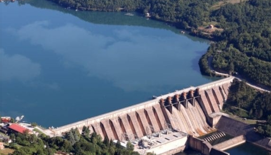
Niger State’s slogan is “The Power State”. The state is known for its abundant hydroelectric power generation capacity, with the Kainji and Shiroro dams located in the state. The slogan also reflects the state’s potential for economic and social development.
Niger State Border
Niger State shares borders with seven other states in Nigeria. To the northwest, it shares a border with Kebbi State, which is known for its agricultural produce such as rice, wheat, and groundnuts. To the north is Zamfara State, which is rich in mineral resources such as gold and lead. To the northeast is Kaduna State, which is known for its diversity and historical significance. To the southwest is the Federal Capital Territory (FCT), which is the capital of Nigeria and home to several government institutions. To the southeast is Kogi State, which is known for its natural resources such as coal, iron ore, and limestone. To the south is Kwara State, which is known for its agricultural produce such as yams, cassava, and maize. To the northwest is Sokoto State, which is known for its textile industry and historical significance.
Niger State Geopolitical Region
Niger State is part of the North-Central geopolitical zone of Nigeria. This region is located in the middle belt of Nigeria and is known for its diversity in terms of culture, religion, and ethnicity. The region is also known for its agricultural potential, with crops such as yams, cassava, and maize being major staples.
Niger State Local Government
Niger State has 25 Local Government Areas (LGAs). These LGAs are further divided into wards, which are the smallest unit of local government in Nigeria. Each LGA is headed by an elected chairman and has a council made up of elected councilors.
Niger State Senatorial Districts
Niger State has three senatorial districts – Niger East, Niger North, and Niger South. Each senatorial district is represented by a senator in the Nigerian Senate, which is the upper chamber of the National Assembly. The senators are elected to represent their districts for a term of four years.
Niger State Main Religion
Islam and Christianity are the main religions in Niger State. Islam is predominant in the northern part of the state, while Christianity is more prominent in the southern part. Other religions such as traditional African religions and Hinduism are also practiced in the state.
Niger State Landmass
Niger State is the largest state in Nigeria, with a landmass of 76,363 square kilometers. The state is located in the Guinea Savannah vegetation zone, which is characterized by grasslands and scattered trees.
Niger State Population
According to the 2006 census, Niger State had a population of 3,950,249, making it the ninth most populous state in Nigeria. The population of Niger State is diverse in terms of ethnicity, with the Nupe, Gbagyi, Kamuku, Kambari, Hausa, and Fulani being the major ethnic groups. The state also has a significant population of migrants from other parts of Nigeria and neighboring countries.
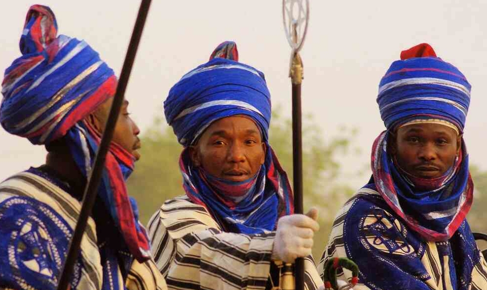
Tribes/ Ethnic Groups In Niger State
The major ethnic groups in Niger State are Nupe, Gbagyi, Kamuku, Kambari, Hausa, and Fulani. The Nupe people are the largest ethnic group in the state and are predominantly found in the western and central parts of the state. The Gbagyi people are mainly found in the southern part of the state, while the Kamuku and Kambari people are found in the northern part of the state. The Hausa and Fulani people are found throughout the state and are known for their trading and pastoralist activities.
Niger State Tourism
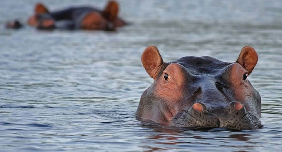
Niger State is home to several tourist attractions that draw visitors from within and outside Nigeria. The Gurara Waterfalls is a popular tourist destination that is located about 100 kilometers from Minna. Kainji Lake National Park is another tourist destination that is located in the western part of the state and is known for its diverse wildlife, including elephants, baboons, and antelopes. Zuma Rock, which is located in the northern part of the state, is a natural wonder that is believed to have spiritual significance. Baro Port is an important historical site that was used for the transportation of goods and people during the colonial era, while the Zungeru Historical Complex is a UNESCO World Heritage site that showcases the colonial history of Nigeria.
Niger State Natural Resource
Niger State is rich in mineral resources such as gold, iron ore, tin, columbite, and tantalite. The state is also known for its hydroelectric power generation capacity, with the Kainji and Shiroro dams located in the state. The state government has been making efforts to attract investment in the mining sector to harness the mineral resources for economic development.
Niger State First Democratic/ Elected Governor
Awwal Ibrahim was the first elected governor of Niger State, serving from 1992 to 1993. He was elected under the platform of the Social Democratic Party (SDP) during the transition to democracy in Nigeria.
Niger State Higher Institutions
Niger State has several higher institutions, including the Federal University of Technology, Minna; Ibrahim Badamasi Babangida University, Lapai; and the Niger State Polytechnic, Zungeru. The Federal University of Technology, Minna is a federal government-owned university that is known for its focus on science, engineering, and technology. Ibrahim Badamasi Babangida University, Lapai is a state-owned university that offers courses in several fields of study. The Niger State Polytechnic, Zungeru is a state-owned polytechnic that offers courses in engineering, business, and other vocational fields.
Niger State: A Brief Overview
- Date of Creation: Niger State was created on February 3, 1976, during the regime of General Murtala Mohammed.
- State Name Meaning: The state was named after the River Niger, which flows through the state and is one of the major rivers in Africa.
- State Capital: The capital of Niger State is Minna.
- State Slogan: “The Power State”
- State Border: Niger State shares borders with seven other states in Nigeria – Kebbi to the northwest, Zamfara to the north, Kaduna to the northeast, Federal Capital Territory (FCT) to the southwest, Kogi to the southeast, Kwara to the south, and Sokoto to the northwest.
- Geopolitical Region: Niger State is part of the North-Central geopolitical zone of Nigeria.
- Number of Local Govt: Niger State has 25 Local Government Areas (LGAs).
- Number of Senatorial Districts: Niger State has three senatorial districts – Niger East, Niger North, and Niger South.
- Main Religion: Islam and Christianity are the main religions in Niger State.
- State Landmass: Niger State is the largest state in Nigeria, with a landmass of 76,363 square kilometers.
- State Population: According to the 2006 census, Niger State had a population of 3,950,249, making it the ninth most populous state in Nigeria.
- Tribes/Ethnic Groups: The major ethnic groups in Niger State are Nupe, Gbagyi, Kamuku, Kambari, Hausa, and Fulani.
- State Tourism: Niger State is home to several tourist attractions, including the Gurara Falls, Kainji Lake National Park, Zuma Rock, Baro Port, and the Zungeru Historical Complex.
- State Natural Resource: Niger State is rich in mineral resources such as gold, iron ore, tin, columbite, and tantalite.
- First Democratic/Elected Governor: Awwal Ibrahim was the first elected governor of Niger State, serving from 1992 to 1993.
- Higher Institutions: Niger State has several higher institutions, including the Federal University of Technology, Minna; Ibrahim Badamasi Babangida University, Lapai; and the Niger State Polytechnic, Zungeru.